I was hoping to get this out there quicker, but rather late then never!
This week I added some map views of all the data to London Bus Pal. There are four “distinct” views of data in the application, but only three maps are interesting (seeing a single bus stop isn’t the most interesting view!).
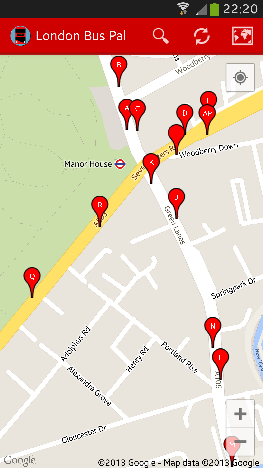
Multi-stop view
If you switch to the map view from a list with multiple bus stops on, you will get a view similar to this. It shows you markers of all the stops near you with their “letter” indicators on, it there are any. This is a really useful view to see any bus stops in the area or near somewhere else you might be going (try searching by post code). Tapping any of the markers will give you the name of the stops and where it goes – if you tap on the information box that appears, you will then be taken to the screen to see the estimated arrival times for all buses serving that stop.
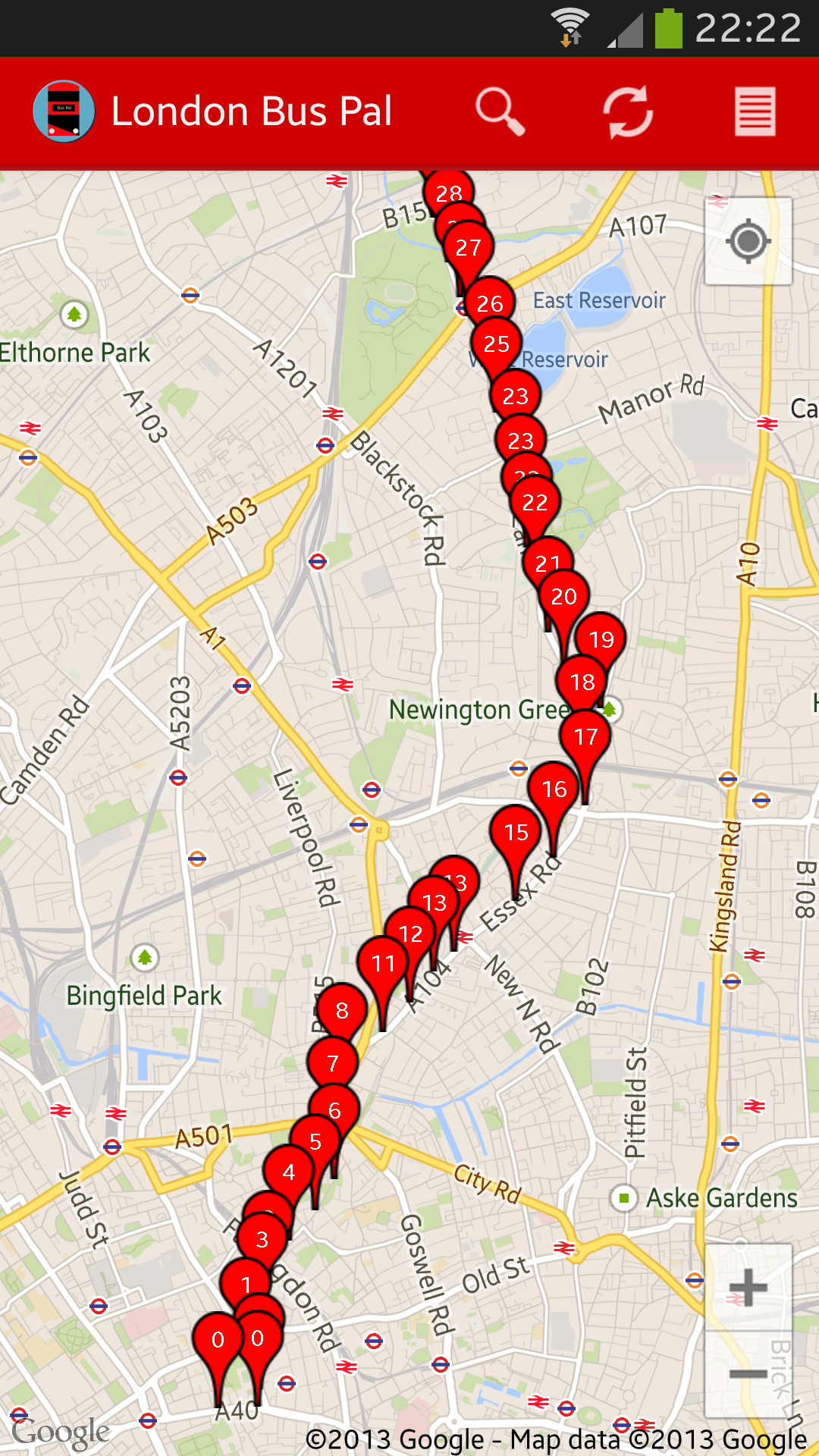
Bus prediction view
The next view that is possible is one showing you a list of all stops for any specific bus over the next 30 minutes and the number on the marker indicates how many minutes the bus is expected to take to get there.
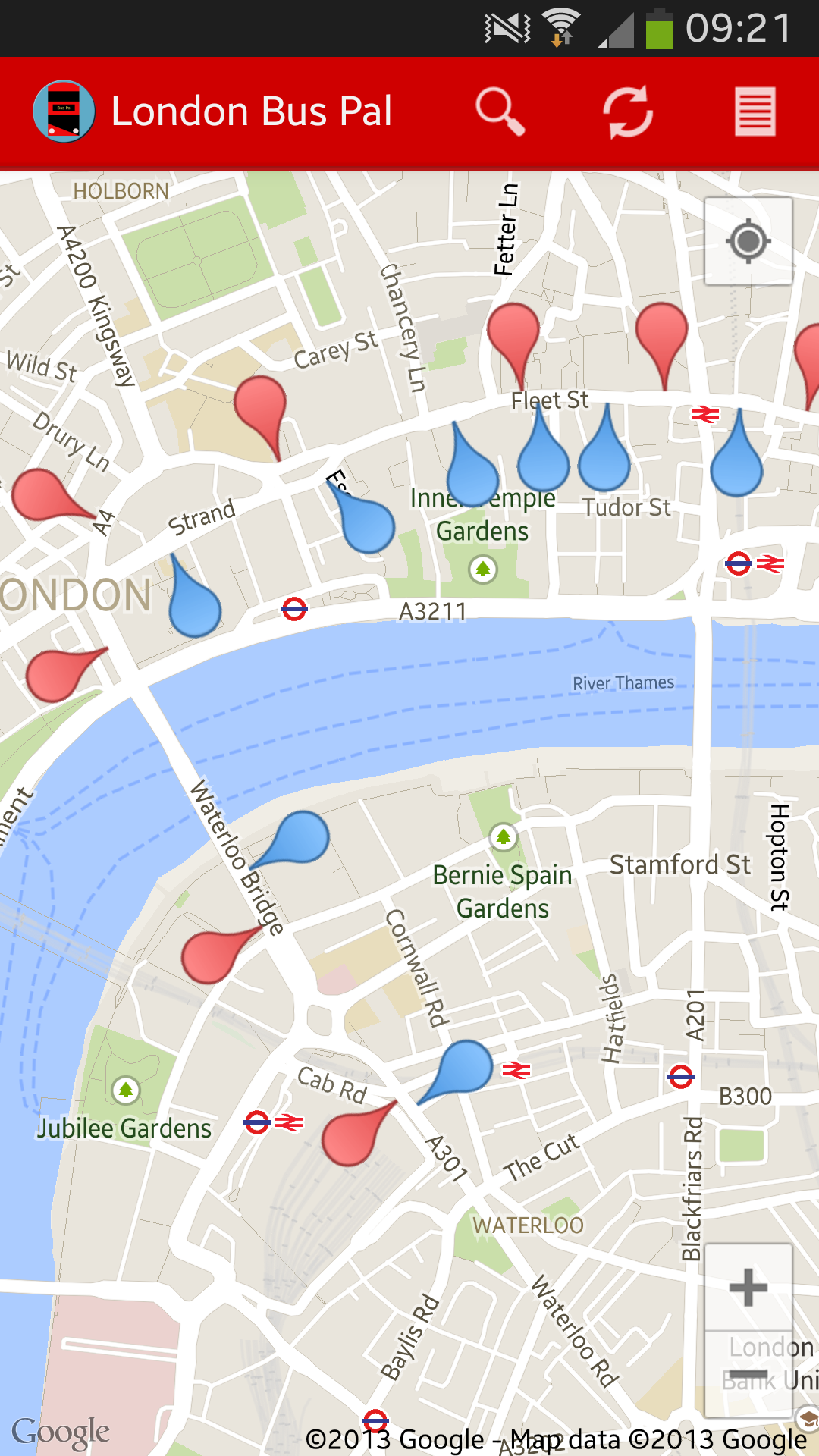
Bus route view
The last view I want to show you, is the bus route view. This is a calculated route based on all buses for that route over the next 30 minutes showing their stops. Red markers indicate one direction and blue markers indicate another direction. The pins are also arranged so that you can get an idea of which way the bus is going (I will add some arrows soon!)
If you don’t have London Bus Pal yet, you can download it from the Google Play Store: https://play.google.com/store/apps/details?id=com.mulder.buspal


